


1 / 6
Image 1 of 6


1 / 6
Image 1 of 6
View all items from Classic Home Furnishings & Décor sale
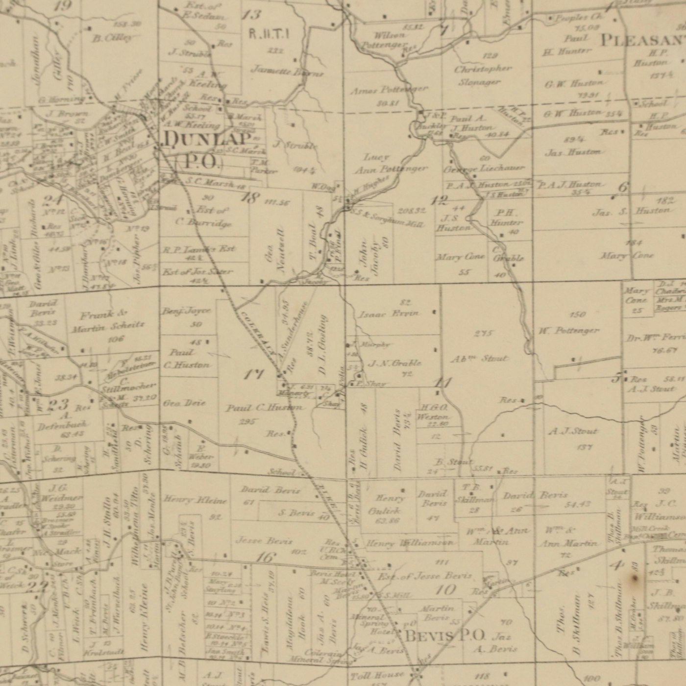
Map of Cincinnati Township "Colerain," 1869
March 20th 2024 @ 7:40pm EST
Winning Bid
$50
Item Details
| Geographical Area | American Midwest |
| Region | Cincinnati, Ohio, Hamilton County |
| Period | Mid-19th Century |
| Date | 1869 |
| Title | Colerain |
| Portfolio and/or Book | Titus’ atlas of Hamilton Co., Ohio: from actual surveys by Robert Harrison |
| Publisher | C. O. Titus |
| Language | English |
| Map Type | Land Survey, Railroad Map |
Condition
- toning and foxing to sheet; tears and loss to edges; abrasions to frame; drill holes to left and right legs of frame.
Dimensions
22.75" W x 20.0" H x 1.0" D
- measures frame.
- Item not examined outside of mounting.
Item #
ITMGM18572


